
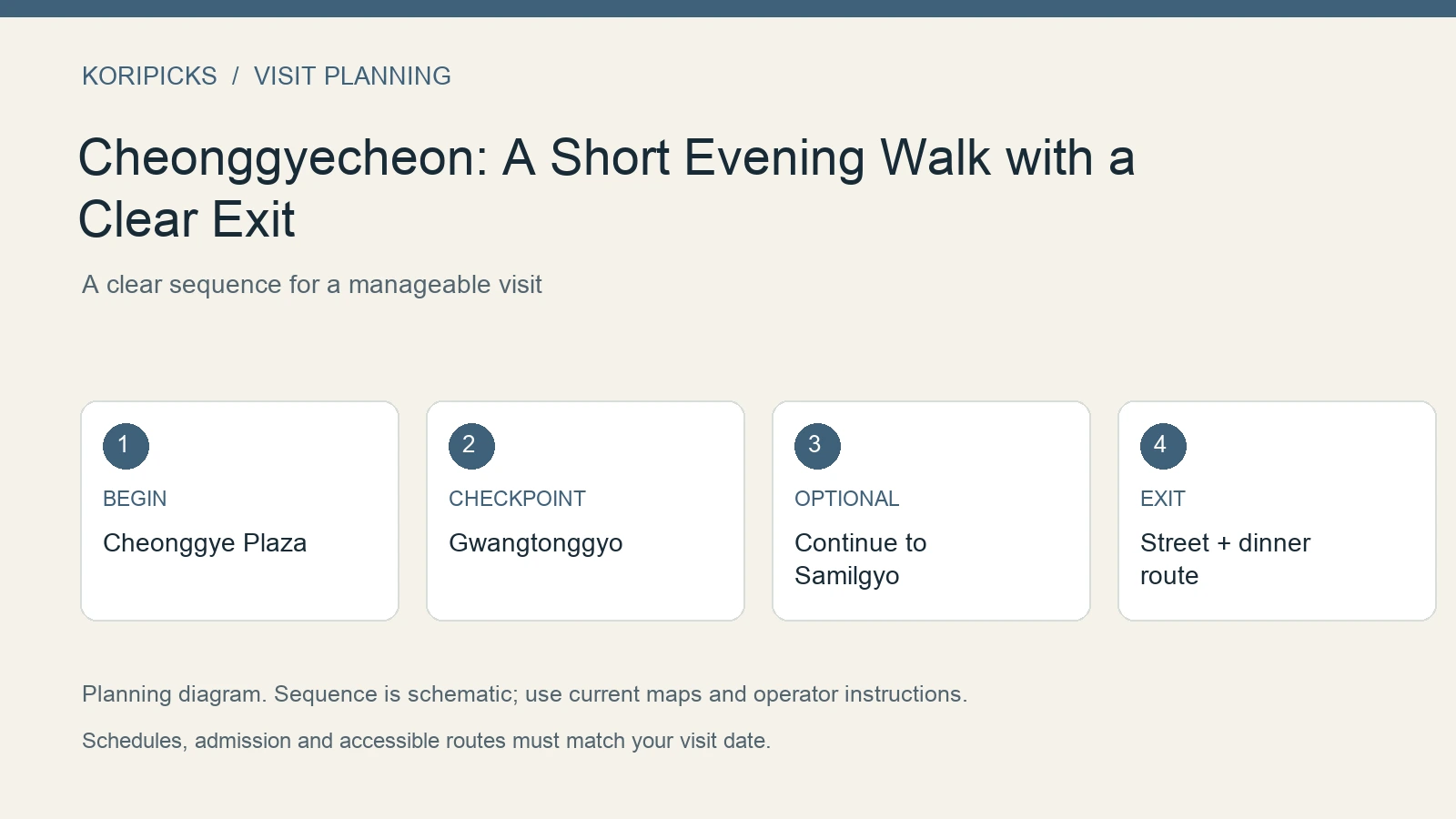
Cheonggyecheon is most useful as a short central-Seoul walk, not an obligation to follow the entire stream. Begin at Cheonggye Plaza, walk east as far as your energy and dinner plan allow, then leave at a bridge you have already identified. A clear endpoint turns an attractive riverside detour into a route you can actually fit between other plans.
For a first evening, allow roughly 45–75 minutes for a short section with photo stops. This is an editorial time allowance rather than an official walking duration. It does not include a meal, a guided tour or a long transfer to the starting point.
The short route and its actual rail ending
For the shortest central version, start at Gwanghwamun Station’s plaza-side approach, go to Cheonggye Plaza, walk to Gwangtonggyo, return to street level by a currently open suitable access point and head toward Jonggak Station on Line 1. The bridge is the end of the stream section; the station is the end of the transport plan.
For a longer version, continue from Gwangtonggyo toward Samilgyo, then leave the lower promenade and use a current surface route toward Jongno 3-ga or the station that best serves your accommodation. Do not continue toward Dongdaemun simply because the waterway remains ahead of you.
The official central stream course identifies Gwanghwamun Station Exit 5 as its meeting approach and uses these central bridges in its route. An independent visit can use that orientation without claiming a reserved guide place.
| Version | Stream section | Transport ending | Suggested outside allowance |
|---|---|---|---|
| Short sampler | Plaza to Gwangtonggyo | Street level toward Jonggak, Line 1 | About 45–60 minutes with stops |
| Longer central walk | Plaza via Gwangtonggyo to Samilgyo | Chosen surface route toward a useful station | About 60–90 minutes with stops |
| Lower path closed | The same landmarks from permitted street level | Your selected station | Shorten the outing rather than chasing an open stair |
The allowances are editorial estimates. The specific ramp, stairs or exit must suit your group and the current access condition. A station listed beside the stream does not prove that every bridge has an equally convenient accessible connection.
A walk with three different observations
At the plaza, look at how the waterway begins within the modern city. Give the relationship between square, sculpture, street and lower path time to register before descending. This makes the stream feel like part of an urban sequence rather than a scenic channel without a beginning.
At Gwangtonggyo, compare the bridge structure with the newer surrounding streets. A close material view and a wider bridge-and-water view show different aspects of the same point. Read the current interpretation where available rather than assuming every element is original and untouched.
At the chosen final bridge, look back along the route before leaving. That is a good final photograph and a practical orientation moment. Once you return to street level, move toward the rail ending or meal you already selected.
Dinner before or after the stream
If dinner is fixed, choose the stream section from the restaurant’s actual district rather than forcing the full route first. A meal near Jonggak works naturally with the short Gwangtonggyo ending. A destination farther east can favor the longer version, but the surface connection should still be saved in advance.
For a flexible meal, finish the stream, move to a named restaurant and review the actual menu. The promenade is not a permanent food market, and an event photograph should not be used to promise vendors along your route. Keep any festival or market visit as a separately confirmed activity.
Accessibility starts before the descent
Look for the suitable way down and the suitable way up before entering the lower path. A level walk that ends at an unusable stair is not an accessible itinerary. Stay on street level when that offers the more reliable route for your group.
That choice still permits a satisfying plaza-and-bridge visit. You can see the waterway’s relationship to the city without making the lower path compulsory, particularly when rain or temporary barriers change its operation.
What the official listing does and does not promise
Visit Seoul’s stream page describes an 11-kilometer waterway beginning at Cheonggye Plaza and passing through downtown. It states that the promenade is generally open around the clock, while rain can restrict access for safety.
That is not a guarantee that you can enter at every stairway on every evening. The street-level city remains usable when a lower path is closed; do not step around a barrier because another visitor does. A short stream outing should have a street-level alternative from the beginning.
Choose your first and last bridge
| Version | Suggested sequence | Why choose it |
|---|---|---|
| First-evening sampler | Cheonggye Plaza → Gwangtonggyo → street exit | Fits a tired arrival day |
| Longer central stretch | Cheonggye Plaza → Gwangtonggyo → Samilgyo → exit | More walking without committing to the eastern end |
| Guided visit | The operator’s confirmed meeting point and route | Adds interpretation, with a fixed start time |
The sequence is an editorial suggestion using named landmarks, not a surveyed navigation map. Verify the actual entrance and exit in a live map. Visit Seoul’s official daytime course uses these central bridges and identifies Gwanghwamun Station Exit 5 as its meeting area, which is helpful orientation even when you walk independently.
If your next meal is near Jonggak, do not continue east just because the promenade does. If dinner is closer to Euljiro, select the bridge exit that serves that destination. The final staircase and street crossing matter as much as the riverside distance.
Find the plaza before descending
Save 청계광장 for the starting plaza and 광통교 for your first bridge checkpoint. At street level, confirm that you are heading along the stream’s eastern continuation rather than circling the square. You can observe the plaza and water from above before deciding whether the lower path suits your group.
For travelers arriving by subway, compare Gwanghwamun, Jonggak and City Hall against the entire hotel-to-plaza journey. The stream connects to many stations, but that does not make every station equally convenient for the same short route. A direct train plus a slightly longer surface approach may be easier than transferring underground.
Do not treat a numbered station exit as an accessibility instruction. Locate elevators and a suitable stream ramp if you need them. A route can be level along the water and still begin or end with stairs, which is particularly inconvenient with luggage.
Street level is a legitimate version of the walk
The lower promenade gives a closer water-level view, but the upper streets can be a better choice in heavy rain, with a stroller, or when you need to remain close to a restaurant entrance. You do not have to descend at the first opportunity to count the stop as a visit.
Before walking down, identify how you will get back up. A bench, stepping-stone crossing or opposite bank seen from above does not prove there is a convenient accessible connection where you need it. Stay on one bank when that keeps the route simple.
If the lower path is closed, follow the street-level bridge sequence and shorten the outing. Do not replace a comfortable central stroll with a long search for an open staircase farther away from your dinner and subway.
Photography that respects a working pedestrian path
Take a wide view near the start and one closer bridge composition. These show more of the stream’s relationship to the city than a dozen near-identical water photographs. Keep bags beside you and avoid stopping abruptly in a narrow section.
For night photos, brace your phone, reduce exposure slightly if bright signs are washing out the frame, and keep enough battery for the route home. Do not climb over a railing or use stepping stones as a tripod platform. A composition should come from the path you can safely occupy.
If the area is crowded, use a bridge-side view from the upper level and move on. The purpose of the short route is a pleasant break, not capturing an empty-city scene that the evening cannot provide.
Rain and festival assumptions are different problems
Rain can change safe access immediately. A festival changes how you plan crowds and timing. Check both, rather than assuming an event notice overrides safety restrictions.
A photograph of lanterns or a seasonal installation is not evidence that those decorations are present tonight. The weekend event workflow helps you check the current edition and organizer. If no current event exists, plan to enjoy the stream and bridges without promising an illuminated show.
Likewise, a nearby market is a separate stop with individual stall schedules and food rules. Do not describe a stream walk as including a permanent night market unless the operating information actually supports that claim.
Joining a guide instead of walking independently
A guided route adds historical context but reduces flexibility. Book the actual course, date and language, then use the confirmation’s meeting point. The Seoul guided walking tour directory is the appropriate starting point; this article does not guarantee that a particular session has spare places.
For an independent walk, the endpoint is yours. Decide before arrival whether you will leave at Gwangtonggyo or continue toward Samilgyo, and save the nearby subway route. That single decision avoids the most common planning mistake here: walking farther simply because the stream has not ended.